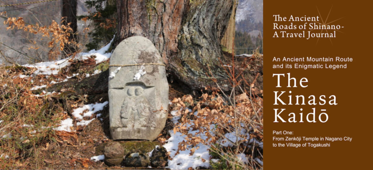
Steeped in history and breathtakingly beautiful, Nagano Prefecture, formerly the Shinano Province, sits in the centre of Japan’s largest island, Honshū. Home to the Japanese Alps, this scenic region is famous for its many mountains, rivers and hot springs, as well as, nowadays, for hiking and snow sports. People have traversed this land since ancient times and many of these historical routes still remain; narrow mountain roads imbued with folklore and tradition. In this series we explore the stories behind the highways and byways of ancient Shinano.
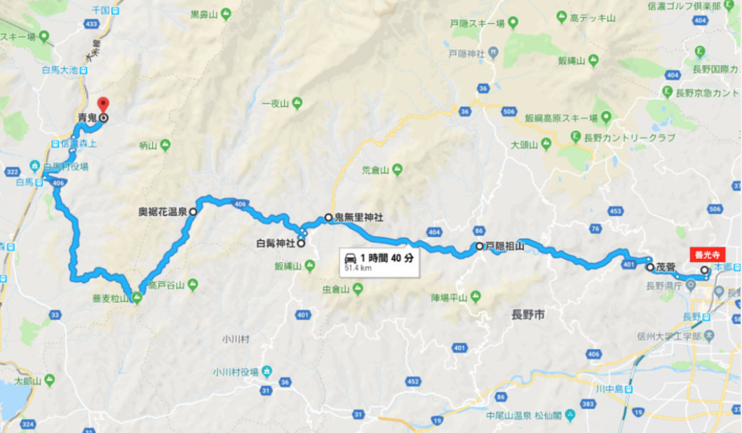
This time we take the Kinasa Kaidō road, driving from Zenkōji Temple in Nagano City to Hakuba Village, with a few detours along the way to explore the side roads and get to the bottom of the mysterious Legend of the Sorceress.
Text : Yūji Fujinuma / Photos : 中島有里子 Yuriko Nakajima / English Version : Judy Evans
Keyword : Hakuba / Aoni Shūraku / Zenkōji Temple / Susobana River / Dams / Driving / Nagano Prefecture / Shinano / Kinasa Kaidō / Nagano City
The Ancient Route from Zenkōji Temple to the Village of Hakuba
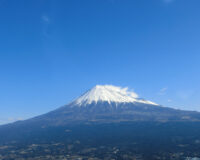
The Kinasa Kaidō route is one of Japan’s historical kaidō, or highways. This ancient route, once a hazardous trail through steep terrain beset with treacherous river crossings and steep mountain passes, leads from the gates of Zenkōji Temple, in the middle of Nagano City, to Hakuba Village, the location of the 1998 Winter Olympics. Nowadays the Kinasa Kaidō is the modern Route 406, a scenic (albeit winding and narrow in parts) drive that rewards the traveller with panoramic views of Hakuba’s Shirouma Sanzan mountains as a dazzling finale.
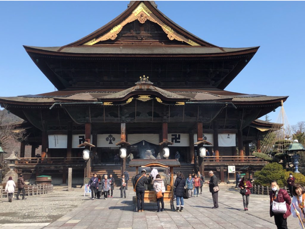
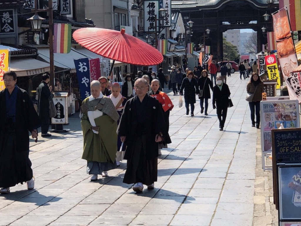
“No Matter How Far, Visit Zenkōji At Least Once”
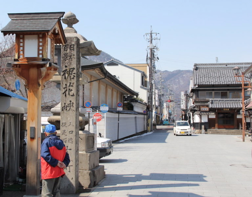
There’s a saying that goes, “No matter how far, visit Zenkōji at least once”. This major temple, a symbol of the Shinshū (Nagano) region, is always bustling with tourists and pious folk. The start of the Kinasa Kaidō is located right in front of the temple. As you walk up the road that approaches the temple and pass under Niōmon Gate, you come to a fairly unremarkable-looking road that extends to the east and west. This is actually an ancient crossroads of sorts. Standing here facing towards the temple, the road that extends to your right and heads east is the old Hokkoku Kaidō, while the road extending to your left, heading west, is the old Kinasa Kaidō. There is little in the way of signage to point out these historical details, but slightly to the west of the Niōmon Gate (left if you’re facing the temple) you’ll see a stone pillar with a carved inscription in Japanese that reads “Nihon Hyakkei Susobana Kyō” (One Hundred Landscapes of Japan – Susobana Gorge). This pillar marks the eastern starting point of the Kinasa Kaidō and refers to the fact that the route traces its way through the Susobana Gorge, which was selected in 1937 as one of Japan’s top one hundred landscapes.
The Road Travelled by the Women of Etchū
The Kinasa Kaidō, less romantically known as National Route 406, runs alongside the Susobana River, through the Susobana Gorge. At its western end, the Kinasa Kaidō traverses the mountains that form the western boundary of the Nagano City district, before arriving at the village of Hakuba. The Kinasa Kaidō (Route 406) ends where it meets the Chikuni Kaidō (Route 148), which runs from Matsumoto in the south to the city of Itoigawa in the north.
Despite once being a treacherous route over steep terrain, the Kinasa Kaidō was frequently travelled. This ancient highway was an important lifeline for essential goods and migrant labour, and was also a pilgrimage route to the Zenkōji Temple and Togakushi Shrine. During the rice-planting season, women from Echigo and Etchū (modern-day Niigata Prefecture) coming to work in the rice fields of the Nagano Basin would make the arduous trek along the Kinasa Kaidō, walking in long processions, woven sedge hats on their heads, and furoshiki bundles and rolled straw mats on their backs.
Following the Susobana River
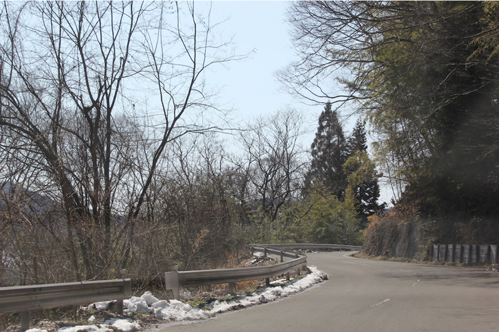
Leaving the hustle and bustle of Zenkōji and heading west, the urban landscape gives way to a narrow road that hugs the base of the mountains. Below us, to the left, the Susobana River flows towards the city we’ve just left. It’s early spring, the snow has disappeared from the southern slopes of the hills to our right, and plump spring buds and fresh green leaves adorn the roadside. In stark contrast, the chilly north-facing hillsides across the river are still covered with snow! This odd spectacle, with spring on our right and winter on our left, continues as we follow the narrow, winding road, hemmed in by mountains on both sides. After a series of bridges and tunnels, we find ourselves now on the opposite side of the river. We come to the turn-off for the Yunose Dam, on the right-hand-side of the road. Leaving the highway, we make our way down towards the Susobana River and across to the other side.
Katsurayama Ochiai Shrine Nestled Quietly among the Trees
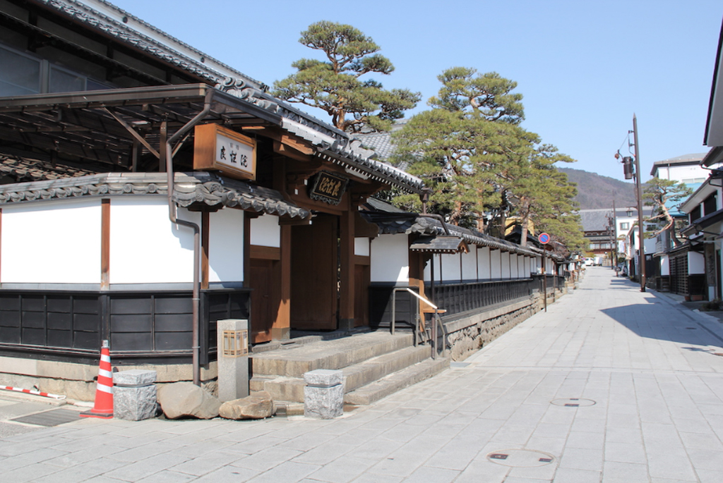
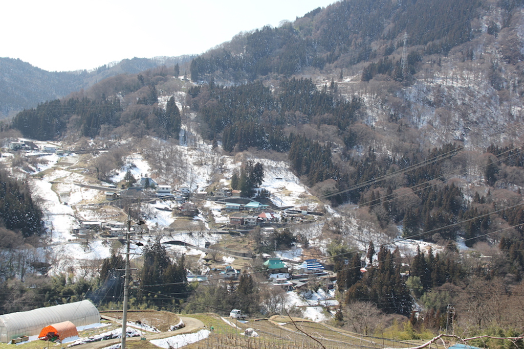
A couple of kilometres further on, we come to Yunose, the site of the former Zenkōji Onsen hot springs. This is where people making the journey to Zenkōji and Togakushi Shrine in the Edo Period would stop and soak their weary bones in the geothermal baths.
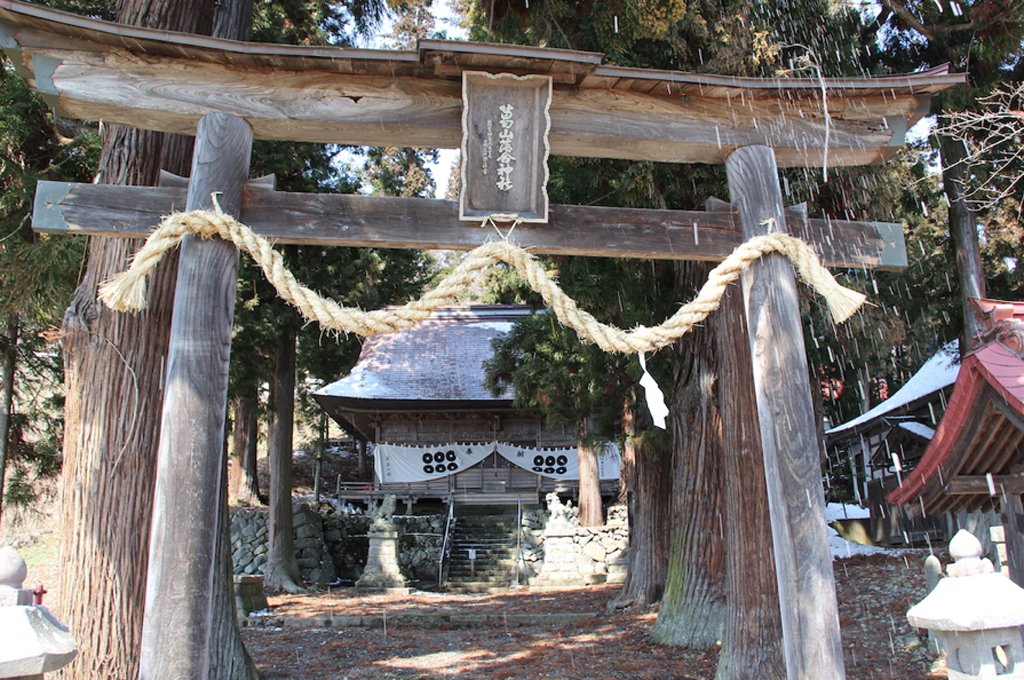
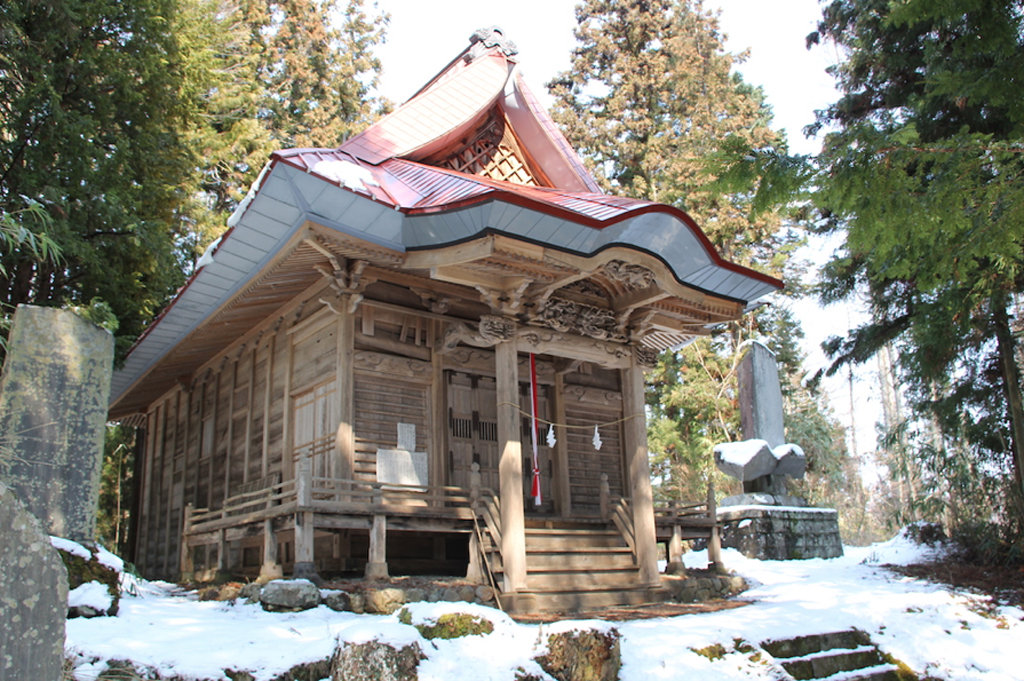
Just before we get to Yunose Dam, the road veers off to the right and up into the hills. After following this winding road around three kilometres we come to Katsurayama Ochiai Shrine, nestled quietly in a grove of trees and looking like just the kind of place where you’d expect to find the guardian deity of a mountain village. The shrine building, which is said to date back to 1465, is constructed in an architectural style unusual for this region and has been designated a national important cultural property.
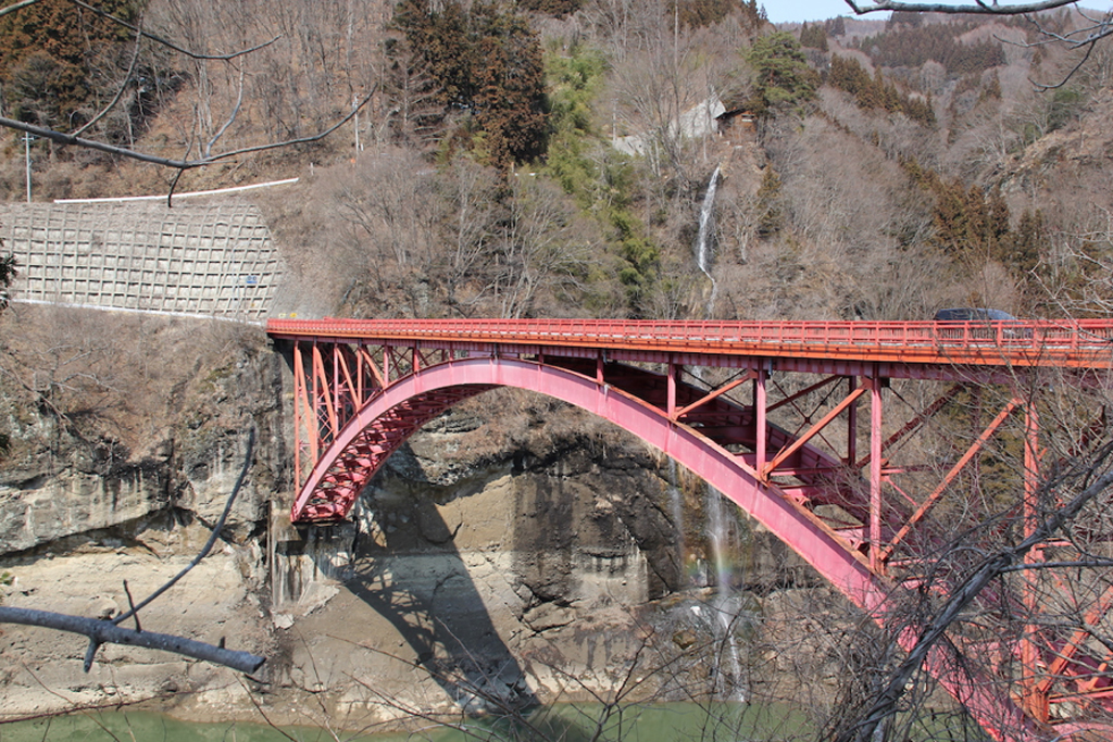
We retrace our path back onto Route 406 and about 2.5 kilometres upstream from Yunose, we find the Susobana Dam, which was completed in 1969. This was once the main sightseeing spot of the Susobana Gorge, and featured overhanging cliffs and spectacular waterfalls. All this scenic beauty was lost with the construction of the dam and the flooding of the gorge.
The Short-lived Nagano-Hakuba Railway
Once-upon-a-time (a very short time), a railway ran through this area. The Zenkōji-Hakuba Dentetsu, commonly known as the Zenpaku Tetsudō, which operated from 1936 to 1944, was intended to connect Nagano City to Hakuba Village. The plan was to eventually take the trains all the way through to Hokuriku in the north and Azumino in the south, via the Ōito Line. The six-kilometre stretch between Minami Nagano and Zenkōji Onsen opened in 1936. Six years later, the line had been extended to Susobana-guchi Station another kilometre to the west and ran regular services carrying up to one hundred passengers at a time. Sadly for the Zenpaku Tetsudō, operations ceased in 1944 and the railway lines were pulled up to be used in the war effort. Traces of the railway remain here and there, in the form of bridge pillars and short stretches of rail, but these are not easily spotted while driving.
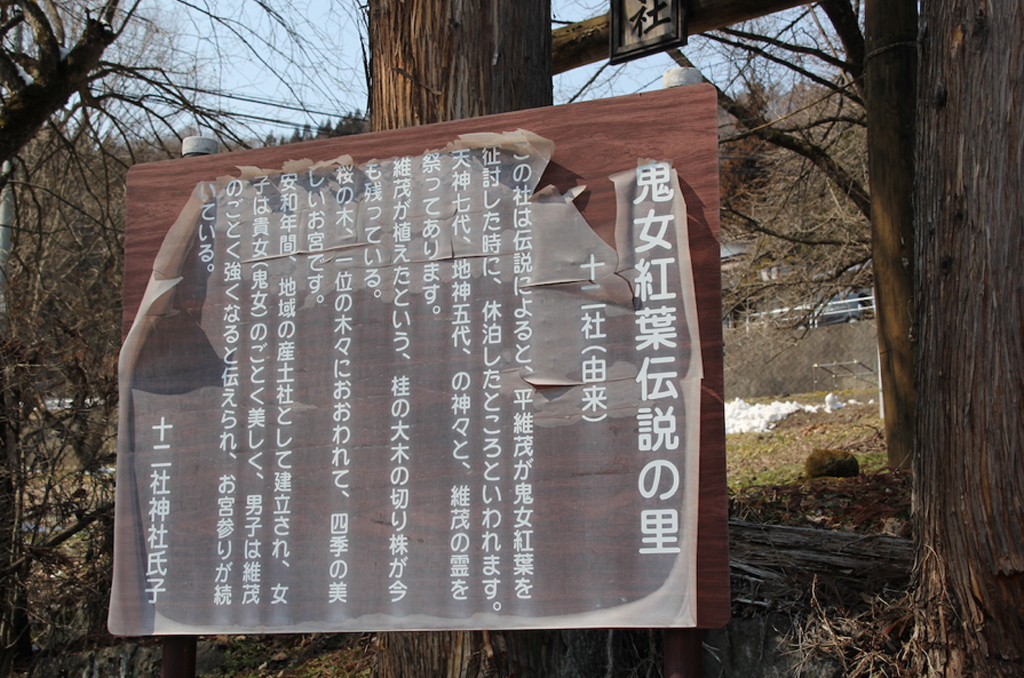
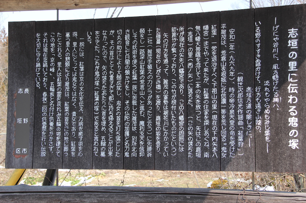
A Sorceress? Or a Noblewoman Adored by the Villagers?
Once past the Susobana Dam and through the Susobana Tunnel, we finally get to the former village of Togakushi-mura, where the Legend of the Sorceress originated in around the 10th century. One version of the legend is that Momiji, a woman of unparalleled beauty, was sent here after becoming involved in an illicit love affair in Kyōto. Momiji, who was familiar with the dark arts, holed up in a cave on Mt Arakurayama. From here, she and her gang of bandits raided the villages of North Shinano and terrorized the villagers. The legendary Taira no Koremochi was dispatched to deal with this demon sorceress and, after a series of adventures and near-misses, he was eventually able to defeat Momiji and restore peace to the area.
Togakushi Village
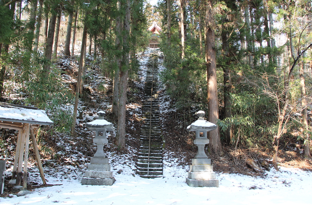
Leaving the Susobana River and driving a little further north into the village of Togakushi, we pass the tiny Jūni Shrine before arriving at Shigarami Shrine, founded in 969. According to legend, Koremochi, tired of searching for the sorceress Momiji, fired two arrows into the air as a prayer to Hachiman, the guardian deity of warriors. One of those arrows is said to have landed right here. At the top of a long, steep set of stone steps through a grove of trees, we find a little old shrine building nestled among the trees.
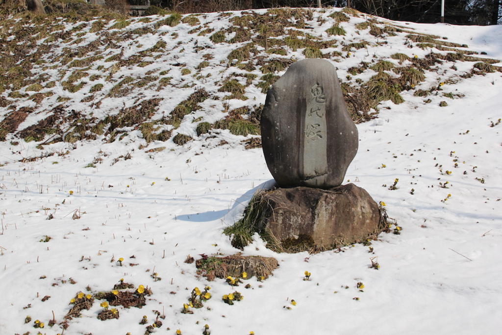
Just a few metres further up the road on the opposite side is the historical landmark, Oni no Zuka, where Momiji’s severed head is said to have been buried. Legend has it that having cut off Momiji’s head, Koremochi found it too heavy to carry all the way back to Kyōto. Reluctantly burying it here, he erected a gorintō Buddhist stupa to mark the burial site.
Mount Izuna, the Birthplace of Izuna Ninpō
About one kilometre to the northwest is Daishōji Temple, where Buddhist memorial tablets commemorating both Momiji and Koremochi are enshrined. The area to the northeast of the temple is flat and open, offering clear views of Mount Izuna. In medieval times, this was a centre for the Shūgendō acetic mountain creed and is believed to be the birthplace of Izuna Ninpō, a school of ninja arts. Practitioners of Izuna Ninpō were said to carry bamboo pipes containing small animals, including the mythological “pipe fox” that was about the size of a rat and had magical abilities. These mythical creatures could get close enough to the enemy to bewitch them, whereupon they could be attacked and killed. Mount Izuna is dotted with steep cliffs and rock faces that were once used for ascetic training. Meanwhile, in the villages around the base of the mountains, people still recount tales of how black magic was used during the time of the Sengoku Period (an era of around 130 years of continual fighting and political upheaval that ended with the unification of Japan under the Tokugawa shogunate in 1603).
Natural Landforms Become the Scene of Legends
Stories relating to the legend of Momiji and Koremochi abound in this region, most of them connected to natural landforms such as distinctive rock formations, springs and plateaus. Arakurayama, the collective name for the range that includes Mt Sunahachi (1,432 m) and Mt Arakura (1,252 m), is where Momiji is said to have had her stronghold. This range runs north-south and forms a natural boundary between the villages of Togakushi and Kinasa. (Strictly speaking, these are “former” villages, as they have now been amalgamated into Nagano City.) Scaling these forbidding peaks involves the use of chains and steel ladders, and is not for the faint-hearted. Gangs of bandits used to hide out in caves on the eastern side of the mountains, such as the one where Momiji is said to have lived. People say Momiji maintained her beauty by washing her face every morning at the Keshōsui spring. Meanwhile, Butai-iwa, a rock formation at the base of the mountain, is where Momiji held her banquets and danced, and is where Koremochi was almost tricked into drinking poisoned sake that she gave him.
It’s not hard to imagine that the legend of Momiji might have been a useful way to keep youngsters from straying too far into these dangerous mountains, but one theory in these parts is that, far from being a demon sorceress, Momiji was a noblewoman who brought knowledge of healing arts with her from Kyōto. The fact that she was buried here rather than being sent back to the capital, and that the local people placed a monument on the spot, suggests that she was revered by the village folk. This idea is reflected in place names still used by locals, such as Kyōnomine (Kyōto Ridge) or Gorin-zaka (Memorial Hill) for the place where Momiji’s head is said to have been buried. Indeed, memorial services are still held every year in spring and autumn, to comfort Momiji’s spirit.
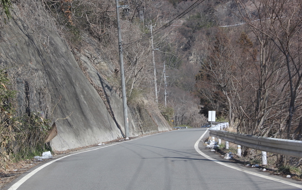
Route 406, the Kinasa Kaidō, passes through mountainous terrain and areas of heavy snowfall, and can sometimes be closed to through-traffic. In winter the road is covered in snow and ice, and during the thaw, melting snow and ice can cause the ground to crumble, meaning that repairs to the road are frequent. Particularly during the snow season, it pays to check on the road conditions first.
Click here to read about the second half of our journey, which takes us over the mountains to Hakuba and continues to the historical hamlet of Aoni.